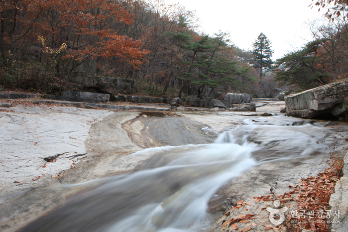
 Photo: Korea Tourism Organization
Mungyeong Seonyudonggyegok Valley
Valley & River · Gyeongbuk · 선유동계곡(문경) (Korean name)
Address
Wanjang-ri, Mungyeong-si, Gyeongsangbuk-do
About
Seonyudonggyegok Valley in Mungyeong is longer and more beautiful than the valley of the same name in Goesan. Daeyasan Mountain (931 meters) runs across both valleys, which are 10 kilometers apart from each other. The valley is relatively untouched as it is not yet well known to the public. At the beginning and the end of the trail are Hakcheonjeong and Chirujeong Pavilions, respectively. Both sides of the valley are lined with thick forests of ancient pine trees. A number of stone carvings can be found in the forest, and the most famous one reads “Seonyugyegok.” It was written by Choi Chi-won, a leading scholar of the Silla kingdom.
Before you go
| Nearest emergency room | 21.6 km — 의료법인동춘의료재단문경제일병원 (Korean name), ER 054-550-7700 |
|---|---|
| Licensed lodging within 3 km | 1 (hotels, motels, guesthouses; pensions not included) |
| Public restrooms nearby | 10 |
| Campsites nearby | 8 |
| Emergency numbers | 119 (fire & ambulance) · 122 (coast guard) · 1330 (Korea travel hotline, English) |
Sources & dates
- Description: Korea Tourism Organization, English tourism information (retrieved 2026-10-12)
- Emergency rooms: National Medical Center (retrieved 2026-10-11)
- Lodging: Ministry of the Interior and Safety, lodging business licenses (retrieved 2026-10-11)
GALAXY PICK introduces places and products and links to them; it is not the seller. Numbers come from Korean public data and may change — check before you go.