Machine translation — this page was translated automatically from Korean and has not been reviewed yet. Names may differ from official English names. (임의 번역)
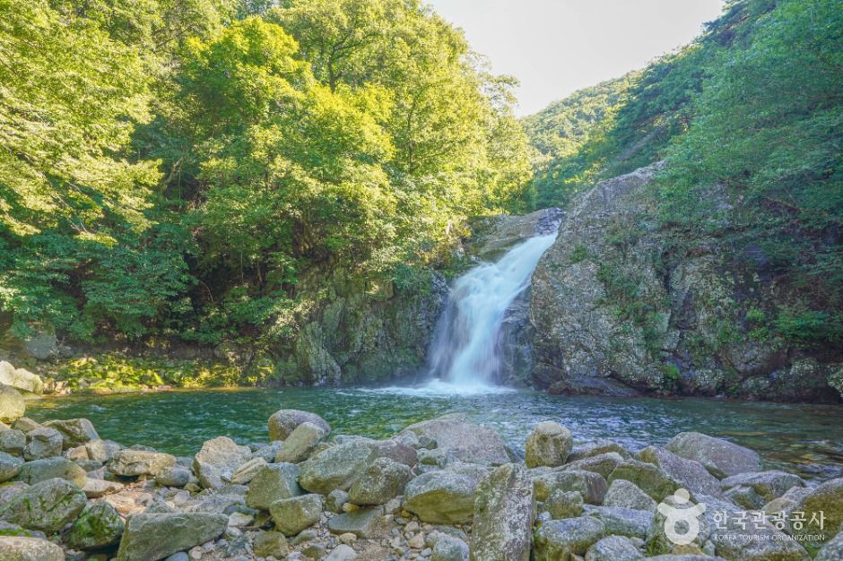 Photo: Korea Tourism Organization
Yongchu Falls
Valley & River · Chungbuk · 용추폭포 (Korean name)
About
Yongchu Falls stands in front of Yongchu Temple, deeper into Yongchu Valley, also called Simjin-dong and one of the three scenic spots of Anui. The valley has the Simwon-jeong pavilion at its entrance and layered granite rocks. Jangsusa Temple, founded in the Silla period, was destroyed in the Korean War, and only its gate remains. Yongchu Valley ends at the Yongchu Natural Recreation Forest run by Hamyang County, with hiking trails to Mount Gibaek and Mount Hwangseok.
Before you go
| Nearest emergency room | 12.7 km — 의료법인대광의료재단괴산성모병원 (Korean name), ER 043-830-5400 |
|---|---|
| Licensed lodging within 3 km | 3 (hotels, motels, guesthouses; pensions not included) |
| Public restrooms nearby | 10 |
| Campsites nearby | 8 |
| Emergency numbers | 119 (fire & ambulance) · 122 (coast guard) · 1330 (Korea travel hotline, English) |
Sources & dates
- Name & description: machine translation of Korea Tourism Organization's Korean tourism information (KOGL), translated 2026-10-12, not reviewed yet
- Emergency rooms: National Medical Center (retrieved 2026-10-11)
- Lodging: Ministry of the Interior and Safety, lodging business licenses (retrieved 2026-10-11)
GALAXY PICK introduces places and products and links to them; it is not the seller. Numbers come from Korean public data and may change — check before you go.