Machine translation — this page was translated automatically from Korean and has not been reviewed yet. Names may differ from official English names. (임의 번역)
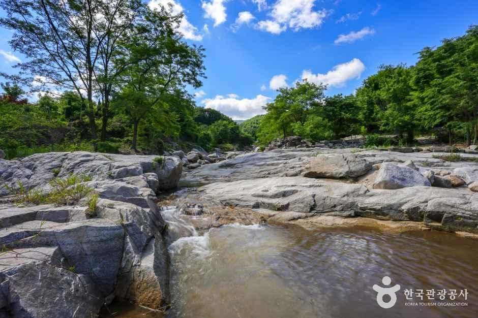 Photo: Korea Tourism Organization
About
Dongsan Valley in Gunwi combines the primeval forest of Mt. Palgong, which rises at its southern end, with clear water flowing over 4 km. Dense forest, clear water and many small waterfalls create a cool, refreshing sound. Long ago it was called "Meokbau" because of its large volume of water, and several waterfalls of various sizes line the valley, adding to its scenery. Nearby sites include Gunwi Samjon Grottoes and Palgongsan Provincial Park, and Provincial Route 79 from Daegu over Hanti Pass is a scenic drive that draws many visitors to the valley in summer.
Before you go
| Free public parking | 4 lots, 236 spaces within 3.0 km |
|---|---|
| Nearest emergency room | 13.8 km — 칠곡경북대학교병원 (Korean name), ER 053-200-2000 |
| Licensed lodging within 3 km | 2 (hotels, motels, guesthouses; pensions not included) |
| Public restrooms nearby | 10 |
| Campsites nearby | 8 |
| Emergency numbers | 119 (fire & ambulance) · 122 (coast guard) · 1330 (Korea travel hotline, English) |
Sources & dates
- Name & description: machine translation of Korea Tourism Organization's Korean tourism information (KOGL), translated 2026-10-12, not reviewed yet
- Parking: Ministry of the Interior and Safety, National Parking Lot Standard Data (records dated 2026-03-11 to 2026-10-01)
- Emergency rooms: National Medical Center (retrieved 2026-10-11)
- Lodging: Ministry of the Interior and Safety, lodging business licenses (retrieved 2026-10-11)
GALAXY PICK introduces places and products and links to them; it is not the seller. Numbers come from Korean public data and may change — check before you go.